Stroud West
The Stroud West course takes in the westerly suburbs of Stroud – Cainscross, Paganhill, Cashes Green, and drops down into Ebley along the canal. It is still pretty hilly, though maybe not quite as steep as the central Stroud area.
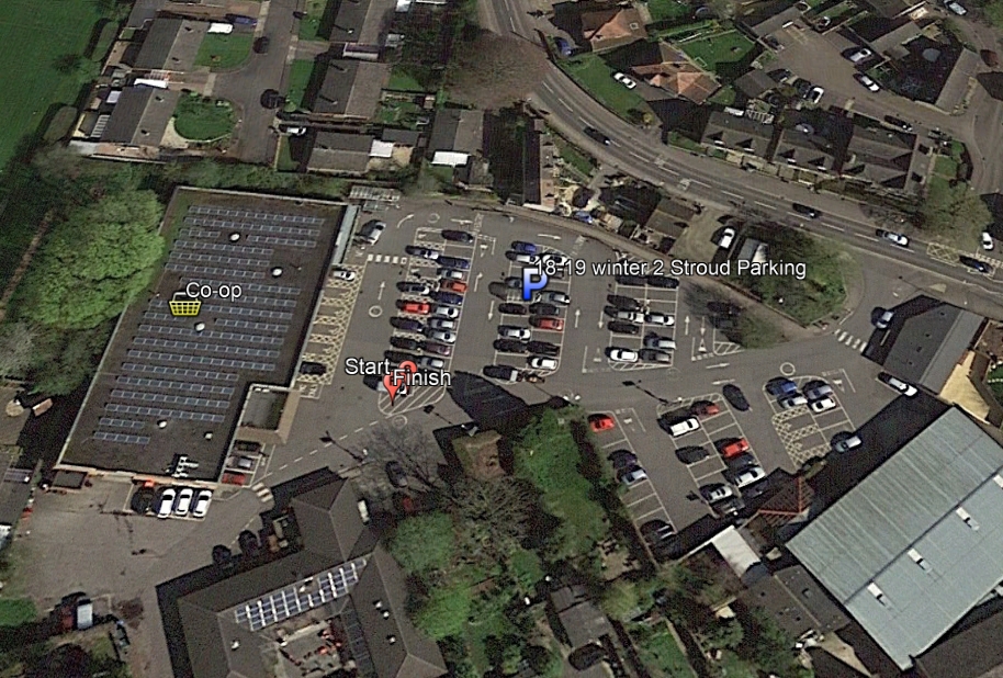
Parking is in the Co-op car park on Cashes Green Road. The start is towards the front end of the car park, just to the left of the store itself, so don’t park too close to that end of it. The car park is for Co-op customers, so you should pop in and buy something.
[bg_collapse view=”button-green” color=”#ffffff” icon=”arrow” expand_text=”Directions” collapse_text=” “]
Click on the running man on the map below, and then the![]() icon to get directions to the course.
icon to get directions to the course.
[/bg_collapse]
[bg_collapse view=”button-green” color=”#ffffff” icon=”arrow” expand_text=”Start and Finish” collapse_text=” ” ]
The Start and Finish are located on the hatched area at the left end of the first double row of cars in front of the store.
[/bg_collapse]
[bg_collapse view=”button-green” color=”#ffffff” icon=”arrow” expand_text=”Course Details and Map” collapse_text=” “]
View the course details and map below. These are all designed to be printed so you have the information to hand as you get on site, but the only thing you need to run the course is the map (and a phone!). We recommend you run with the course map and details sheet together back to back in a plastic wallet to keep them dry!
View or print the course map
View or print the location details
View or print checkpoint descriptions and getting started information
[/bg_collapse]