Longlevens
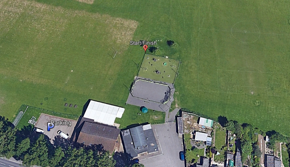
The venue for the Longlevens maprun course is Longlevens Rugby club car park. We have asked the club if it’s Ok for maprunners to park there, but the message may not have got to everyone, so if anyone queries your presence, explain what you are doing, and that we thought we had agreement to park there. If they really object, you can park out on one the nearby roads. The start/finish are open to public access.
[bg_collapse view=”button-green” color=”#ffffff” icon=”arrow” expand_text=”Directions” collapse_text=” “]
Click on the running man on the map below, and then the![]() icon to get directions to the course.
icon to get directions to the course.
[/bg_collapse]
[bg_collapse view=”button-green” color=”#ffffff” icon=”arrow” expand_text=”Start and Finish” collapse_text=” ” ]
The course starts and finishes at far left corner of the fence, looking from the car park, around the children’s play area next to the clubhouse. It’s next to the mound with two or three trees on it. Make sure you run through this point to start your route, and again back through it to stop the clock on your run.
[/bg_collapse]
[bg_collapse view=”button-green” color=”#ffffff” icon=”arrow” expand_text=”Course Details and Map” collapse_text=” “]
View the course details and map below. These are all designed to be printed so you have the information to hand as you get on site, but the only thing you need to run the course is the map (and a phone!). We recommend you run with the course map and details sheet together back to back in a plastic wallet to keep them dry!
View or print the course map
View or print the location details
View or print checkpoint descriptions and getting started information
[/bg_collapse]